

I began writing this to accompany the images we took while out walking around Higgar Tor, Carl Warl and Over Owler Tor today and while doing the research found out something quite surprising. It’s not earth shattering as such but the fact that I was born and brought up in Sheffield without even knowing this fact is a bit odd, I’ll save that for later.
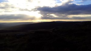
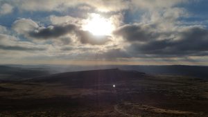
Anyway, about our Sunday walk. At just under 6 kilometres a walk taking in Over Owler Tor, Higgar Tor and Carl Wark isn’t too testing for us these days, though we have done quite a few walks this week and the route we took had plenty of climbing plus a bit of boggy ground to traverse. So it was quite enough for today thank you!
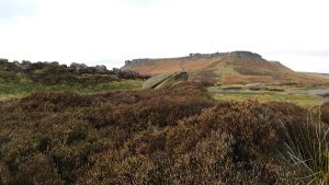
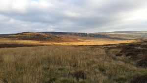
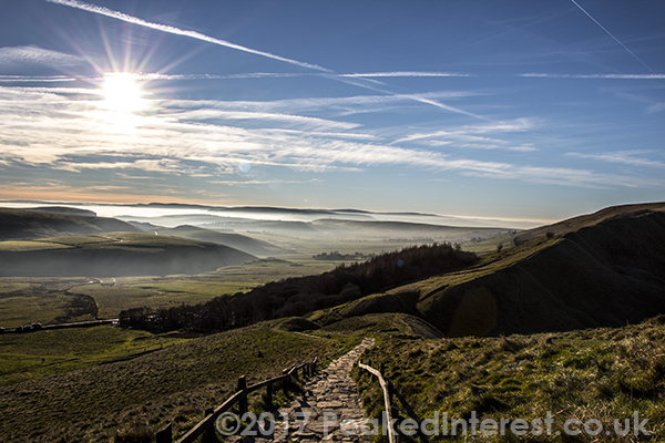
I’ll not go into too much detail suffice to say we parked at the south end of Stanage Edge, traversed the field in the crook of the Fiddler’s Elbow and approached Higgar Tor from the North. We walked anti-clockwise around the plateau at the top of the tor then descended the rocky South side and walked across the moor to the East corner of the dry stone walled sheepfold. From there it was straight across to Over Owler Tor then back across the moor, bearing off in an easterly direction towards Carl Wark and finally back from carl Wark up the southeast corner of Higgar Tor and back to the car.
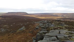
So, here’s what I just found out. Like most ancient hill forts Carl Wark doesn’t have a simple history. Even today with our technology and earth moving machinery it would take some time to construct a fort like Carl Wark. In fact imagine how long the earth ramparts at MamTor would take to excavate! Anyway, with that in mind it stands to reason that a site that has been dated at anywhere from the late Neolithic to early Middle Ages didn’t just have one use and would have taken years to construct with each successive occupier of the site adding their elements to it as time, resources, wealth and defensive needs dictated.
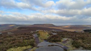
For example the original site probably didn’t have the defensive wall now visible on the west side of the fort. That arrived in the early Middle Ages/Dark Ages perhaps 100 years after Roman rule in Britain collapsed. It’s quite a small fort in terms of area so as you’d imagine it wasn’t permanently occupied, just during times of need. The archaeology seems to support this idea of Carl Wark being a defensive refuge rather than the centre of a settlement.
So why did the various people who have used the rocky outcrop chose it instead of the much larger and higher Higgar Tor. Well in my opinion it’s far better suited to the needs of a pre-industrial societies needs. Populations were lower so you don’t necessarily need a huge redoubt, this isn’t Game of Thrones. A smaller defensible position can be held by fewer people requiring fewer supplies. But perhaps most crucially the naturally steep rocks on the north, east and south sides of Carl Wark mean you only have to really defences on its western approach. Now, having said that the impressive stone wall in evidence today on the western edge of the site dates from around the fifth or sixth century AD – who’s to say there wasn’t a earth bank or timber wall there before that. Fortifying Higgar Tor would have been the work of decades because only the South and East sides have anything like a naturally steep approach, the rest of the fort would have to be constructed, by hand at a time when just surviving the next winter was often a tribe’s primary concern.
And now to the interesting fact I discovered. There’s a hill fort at Wincobank in Sheffield. I may be the last one to know about this but that site, Carl Wark, Mam Tor and potentially others may have been part of a defensive line attempting to stop the Romans marching up the country in the first century AD. Or of course they might not, because with little unbiased testimony from that time and no written history from the indigenous peoples of Britain who knows. Nice story though.


Recent Comments