
We began our walk in Cave Dale by parking outside the centre of Castleton. Approaching Castleton via Pindale along Pindale Road. Taking care to respect the residents only parking areas we were lucky enough to find a parking space on the edge of the villages in front of some beautiful stone cottages. It was just a short walk down Bargate to the entrance to Cave Dale and the Secret Valley on the left.
The start of this walk is very much like the start of the Penine Way in Edale. You walk past a row of country cottages to be greeted by what appeared to me being an asthma sufferer, the death of me. Lol. It’s a hill so steep it feels like climbing the start of Winnats Pass in an overloaded Mini requiring the use of 1st gear only. Climbing boots are a must on this terrain.
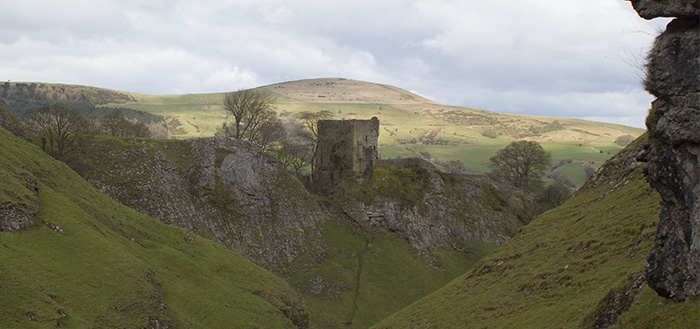
I started up the scree covered path which moved under foot and had a stream running down it for much of the ascent hoping that things would even out. They didn’t. The climb was a continuous one which takes in some breath taking scenery including a backdrop of Bamford Edge with Peveril Castle on your right as you climb.
About the time my calves started to complain a chap with a spring in his step came down the hill and after we had exchanged Hellos I asked if the climb would get any easier. His response was a smiling “No”.
It was at that point that I knew I should simply grit my teeth and bear it.
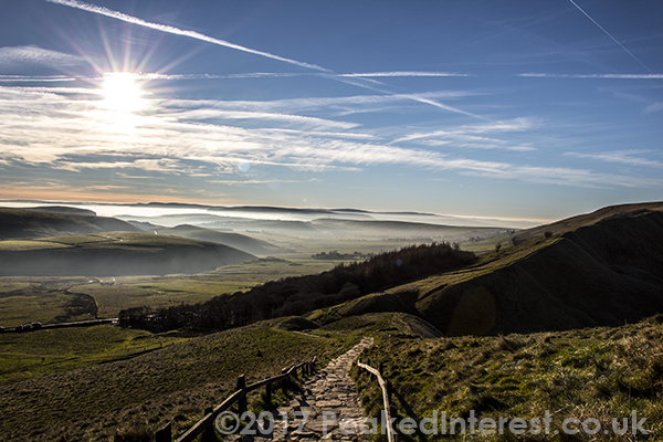
The ascent seemed to go on and on but the reward is the views across the Hope Valley. As you climb you will see sheep and Wheatears on the steep embankments too, as well as the ever-present corvids.
When you finally reach the top of the valley there is a signpost, at which point you need to turn right, in fact almost back on yourself. This takes you over the ridge on the North of Secret Valley towards Hurd Low and Cow Low.
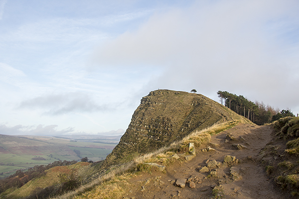
You continue to make a less steep climb to the very top of the hillside which is about 100 yards and the view from the top makes you realise exactly why you hike up those hills. 🙂
The panorama takes in some of the most interesting features the Peak Park has to offer. With Mam Tor and Kinder Scout to the left (North). It’s stunning up there.
We took lots of pics and sat and ate our customary banana up there before heading down the hill towards the path back to Castleton.
Descending the hillside was a gentle gradient which unfortunately lead us to a nightmare of a decent next to Peveril Castle. The path was not only steep and uneven but very wet making the holes made by previous feet very slippery and sometimes fall away as you stood on them when the wet ground gave way. It was a nightmare to negotiate.
I believe that the less risky route is to descend diagonally across the hillside but like many we were drawn to look at Peveril Castleand away from the actual footpath. It’s typical that we always take the tough route. Lol
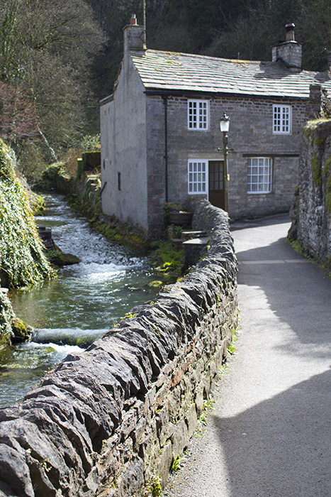
This path brings you out behind the high street in Castleton. It’s a lovely little backwater with the large Brook Peakshole Water meandering through it.
There’s no doubt that this walk is challenging and not one for those wishing for a gentle climb. I found making regular stops aided my ascent and the climb is well worth the breathless moments.

Recent Comments